You’ve all been there, spent ages on Google Maps trying to plot a perfect super twisty route down all the quiet back roads; but come unstuck when trying to follow the route whilst on the bike. At the end of the day, you’ve got a computer with a route on the screen and a phone in your pocket with a GPS and maps – why is it so hard to plan your route from one point to other and then ride it? This howto guide goes through all you need to ride a route off Google Maps on your bike, using your phone.
First up, the hardware required, you will need:
A Phone
I wrote this howto based on an Android phone, but it’s mostly generic enough to apply to an Apple iPhone too but you’ll need a different choice of GPS app.
Headphones/set
 Something to listen to direction with. This could be as simple as a hand-free kit with wired earplugs, connected to your phone in your pocket. Otherwise, there are countless Bluetooth headsets available, some cheap, some expensive. I’m using the super cheap Chinese Freedconn T-COM headsets (click for my review) off eBay which is perfectly sufficient.
Phone Mount (optional)
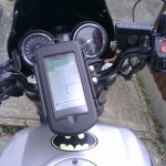 Although you can get by with audio directions only, it can be handy to glance at the screen, to see the exact route you need. Especially on busy interchanges or roundabouts with many exits.
Again, there are many expensive options, Quadlock etc, but also many cheap options on eBay has tonnes of phone mounts. Some are phone-specific, some universal, each with varying levels of waterproofness. I’ve used the chunky Herbert Richter case (click for my review) and more recently the ShapeHeart soft case (reviewed here) with magnetic attachment.
USB Power Source
Phone GPS apps will drain your battery fast, so if you want to ride for more than a couple of hours you will need a USB power source to keep your phone running.
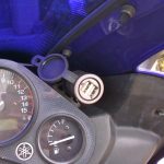 Yet again, eBay is full of USB sockets you can wire into your bike’s battery. Some bolt to your bars, some flush into the fairing, some combine fag lighter sockets and some with low voltage cut out. Go hunt around, and take your pick. Most install easily enough and just wire straight to the battery, though plugging in a relay is preferred to avoid unwanted battery drain.
I’m using an old Maplin USB socket (click for my review), which is unfortunately discontinued.
That’s all the gear you need, let’s get started and create our route.
Google My Maps
Not to be confused with the default Google Maps webpage, you need to use the Google ‘My Maps’ app on Google Drive, as this will let us export our route to a KML file.
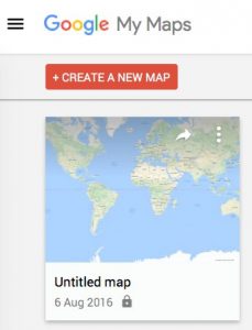
Use the link above and hit the big red ‘Create a New Map’ button.
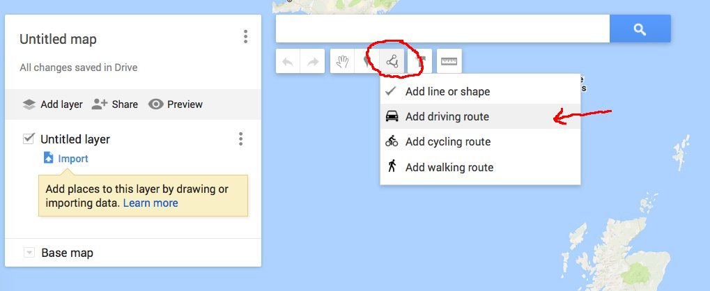
On your fresh map, you will need to add a ‘Driving Route’ layer, as the default layer does let us add waypoints. Use the little point-to-point icon and click ‘Add driving route’ in the drop-down menu.
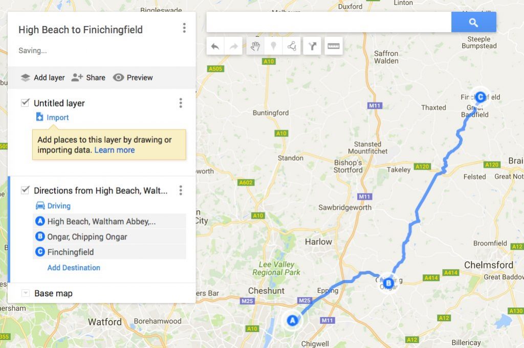
Now we can create our route. Either add destinations manually to the layer in the left-hand panel or draw a route directly on the map. You can drag the route around as you like, rearrange waypoints and generally tinker until you have your perfect ride laid out.
Give the route a name, by clicking on the title at the top. You can also delete the original default layer too or use it to add points of interest along your route.
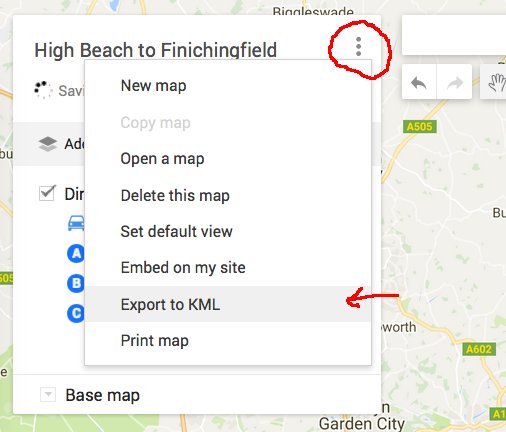
Now we can export out route. Google My Maps supports the standard KML/KMZ format. The top menu (three dots next to the title) has the option to export.
On the export options, we select the KML format. You can also choose to export all layers or just one.
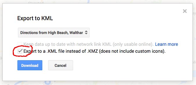
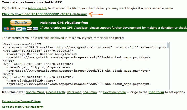
Click download and save the file somewhere handy. Next, we need to convert this KML route format to the GPX format, which is what our phone GPS app will read. This can easily be done with a free webpage GPX converter at GPS Visualiser. Simply upload your KML file and hit convert.
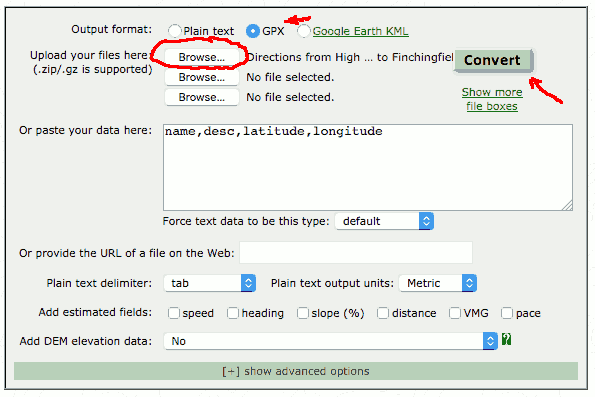
We can then download the new GPX file, which we will be copying to your phone shortly.
OsmAnd GPS Navigation App
Next up we need a phone app that can read our GPX route. Unfortunately, the Google Maps phone app can’t do this. 🙁 So we are going to install the app OsmAnd, which is free, uses a downloaded map and does a reasonable choice of navigation. This is available both on Google Play Store and Apple App Store, however, the iPhone version has no navigation…
So first things first, go download this app and download the offline maps for your region.
Transferring GPX File to Phone
To use our GPX file in OsmAnd it needs to be placed in the tracks folder of this app. The settings screen of OsmAnd will tell you where its data storage folder is (on my phone /media/sdcard0/maps/osmand as I moved it to the sd card to fit map downloads).
You can copy the file in a number of manners, Bluetooth, USB cable or using the Android FileTransfer app (best plan for Mac users).
Beginning Navigation
Now we have everything in place, I’ll show you how to kick off navigation and get riding. In the OsmAnd app hit the navigation button at the bottom: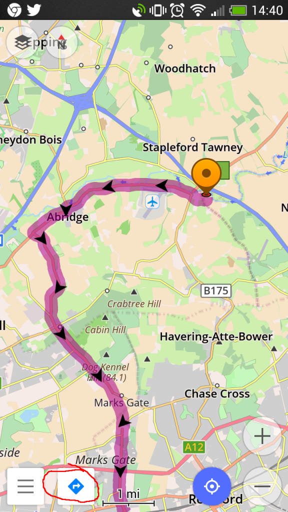 Next hit the navigation options button.
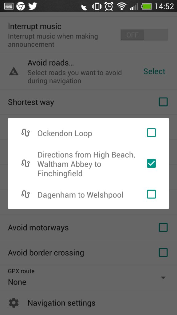
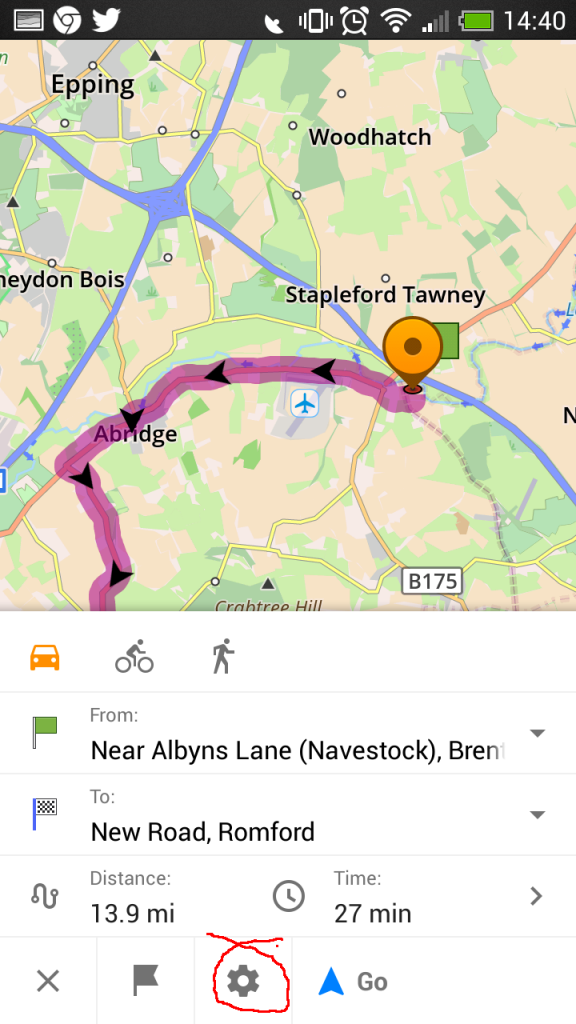 From here we can select the GPX file we previously copied into the osmand/tracks folder.
 This will bring up a menu of all the GPX routes copied over.
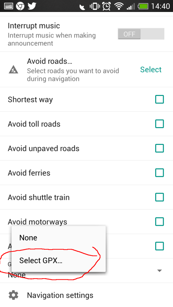
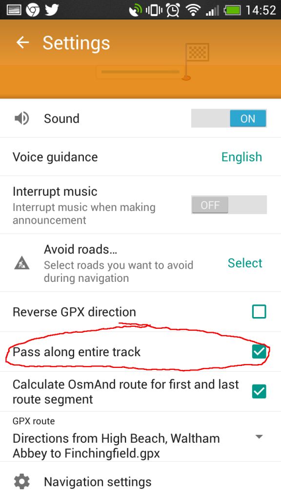
 After selecting the route, we should tick the option to ‘Pass along entire track’, otherwise OsmAnd will try to take shortcuts and skip the start of the route if you are already closer to the endpoint. Ticking this option will force navigation to take you to the start of the route and direct you along its entirety.
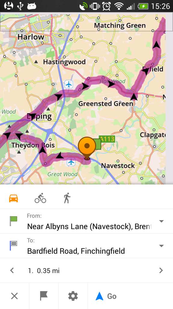
 Now you’re ready to just hit the Go button.
 As you can see, this plan isn’t quite as straightforward as a proper SatNav, but it’s a hell of a lot cheaper. I have had the OsmAnd app crash a few times, so I’m still on the lookout for something better. Nonetheless, the first half of this guide to creating the KML and GPX route files should still apply regardless of your choice of phone app.
This is definitely one of those areas where things change, software gets updated, new apps pop-up, old apps get discontinued etc. There will be alternative software for each of these steps, this is just the method that worked well for me. But, I would be more than glad to hear of better approaches you know of, so please drop a comment if you know of some funky better apps.
6 replies on “Howto: Plan & Follow a Google Maps Route on Motorcycle with your Phone”
Great article – I’ve been wondering how to do this for months. Currently, I use Google Maps saved favourites and stop at each point and navigate to the next point.
I tried your method but couldn’t get used to OsmAnd’s way of dealing with roundabouts – i.e. “Turn right” where Google Maps would have said “Take 3rd exit on A111”.
I’ll look into some other navigation apps which can import GPX.
Thanks!
This worked great. Thanks a lot for instructions.
Although, for some reason OsmAnd did try to route me different way on some intersections. It did show my track, but also added suggestion which I think it calculated as faster route. Will play around with settings.
Thanks again for this Arthur.
Nice and clear. Got it all loaded up and working in 30 minutes including a route!
Cheers
Been searching for something like this for a while, and finally found this… brilliant
So pleased I found this. Instructions were really clear and easy to follow. You’d think MyMaps in Google would have navigation of pre-planned routes! Yours is a great compromise. Set up a local test route of a few miles. Works a treat.
Hi Arthur, I really appreciate the info that you just give us. I have been looking for a solution to offline maps with navigation option and a route tracker. OsmAnd is the perfect solution for that. I was stalled at My maps with no navigation option. There are some phone mounts with wireless charging on the market. I had already one that has purchase on Aliexpress, which fit perfectly to my beemer. With this chargers you just forget about the mess of the cables of type C or A chargers.
Greeting from Lima, Peru